Museum App Mockup
-
Introduction
Brief: Build an app for the Irish Jewish Museum, turning a static visit into a dynamic, interactive experience.
Challenge: Most visitors missed the rich history of “Little Jerusalem” beyond the museum walls.
Goals: Make the museum and its neighborhood stories accessible, engaging, and interactive.
-
Discovery Phase
Stakeholder interviews: Met with museum staff and local historians.
Business requirements: Highlight museum content, connect users to the surrounding area, and support future digital features (QR codes, audio).
User needs: Simple navigation, easy access to stories, and a sense of discovery.
-
Problem Framing
Problem: Visitors don’t realize how much history is just outside the museum.
Success: Users can explore both the museum and neighborhood stories in a few taps.
Constraints: Must work for all ages, support audio/image content, and be easy to update.
-
User Research
User interviews: Talked to museum-goers and locals about what they wish they’d known.
Competitive analysis: Checked other museum apps—most were too text-heavy, not interactive.
Market research: Geolocation and audio tours keep visitors engaged longer.
-
Synthesis
Personas: “The Curious Tourist,” “The Local Explorer,” and “The History Buff.”
Journey mapping: From app open → museum intro → map view → hotspot stories → audio/photo content.
Key insights: Geolocation and multimedia make history feel alive; navigation must be dead simple.
-
Solution Development
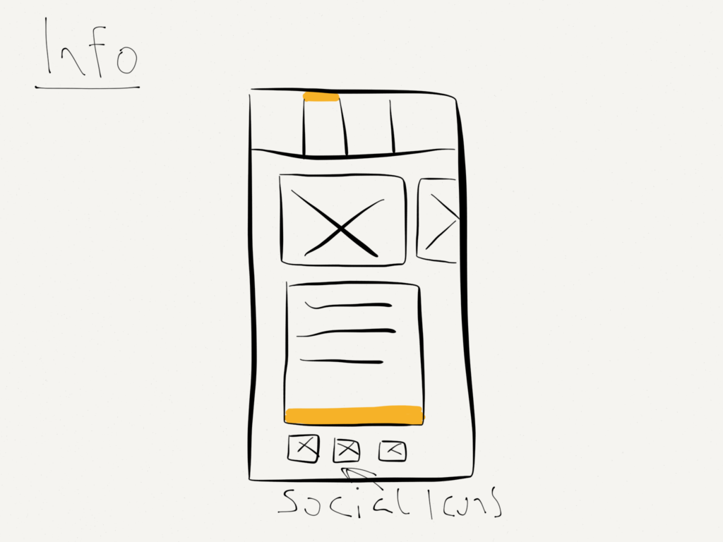
Info architecture: Top nav for museum info/history, map view for neighborhood exploration, future QR integration.
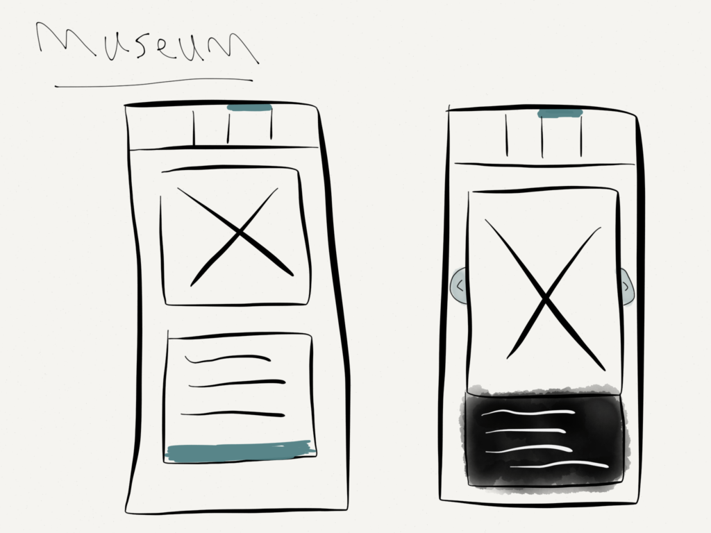
Wireframes/prototypes: Sketched quick flows, then built interactive mockups for map and story hotspots.
Visual design: Clean, inviting, big tap targets, and plenty of photos.
-
Testing
Usability testing: Ran with visitors of all ages—flagged confusing icons and unclear map hotspots.
User feedback: Simplified map, clarified hotspot actions, and added more visuals/audio.
Iterations: Refined flows
-
Implementation
Handoff: Delivered annotated wireframes and media asset lists to devs.
Dev collab: Worked closely to optimize for image/audio loading and map performance.
Go-to-market: Rolled out as a pilot in the museum, with plans for future QR and iOS expansion.
-
Results & Impact
Metrics: Higher engagement time, more hotspot interactions, and positive visitor feedback.
User adoption: Visitors explored more of the neighborhood and shared stories with friends.
Business impact: Helped the museum connect with both tourists and locals, and positioned them for future digital growth.
Lessons learned: Geolocation + multimedia = more memorable museum visits.
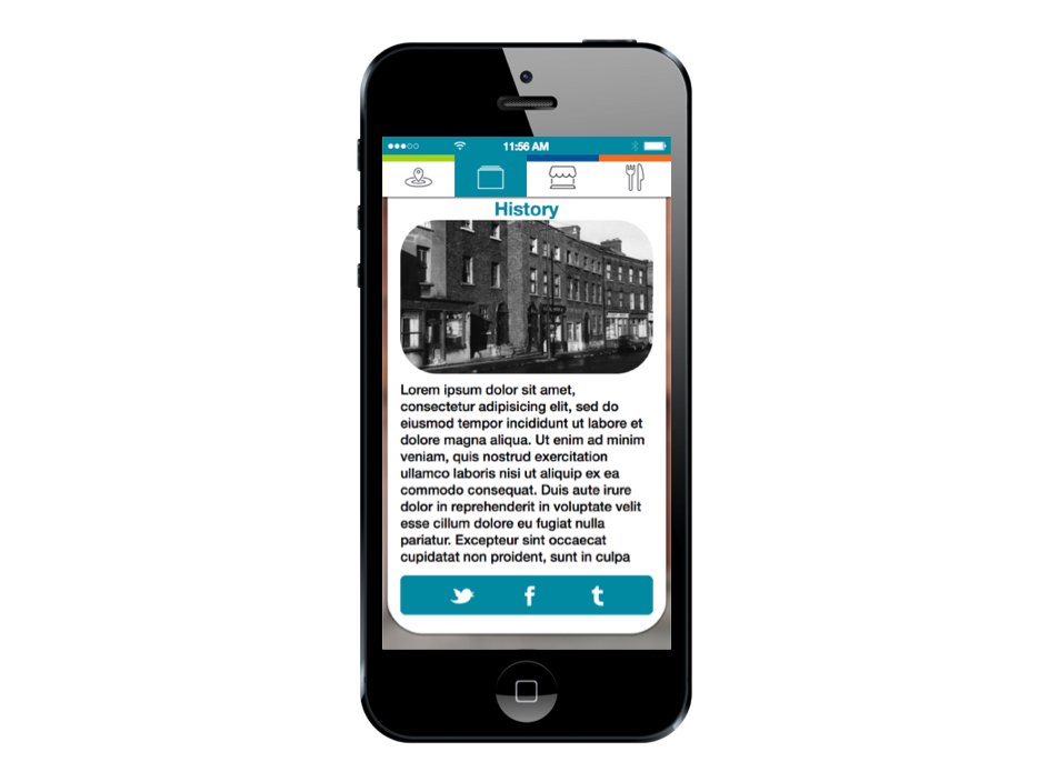
The Irish Jewish Museum stands on the site of Dublin’s Walworth Road Synagogue, which was once in the heartland of “Little Jerusalem,” the densely populated Jewish enclave off the South Circular Road. The area was filled with Jewish kosher butcher stores, Jewish bakeries, Jewish grocery stores, Jewish tailors, Jewish bookstores and many other stores and businesses owned by Jews.
Research into the creation of an app for the Jewish Museum revealed that while users visiting the museum would be unaware or bypass the other historical shops and stores that surrounded the Jewish corner.
The decision was made to not only have the app enhance the museum but the other business would have interactive elements integrated into the app to give a virtual walking tour of Ireland’s Little Jerusalem
Before starting anything, I spent a lot of time discussing the vision for the app. After that, I wireframed a lot on journeys. This helped me get out ideas in a quick and dirty fashion so we could discuss the design and flow of the app.
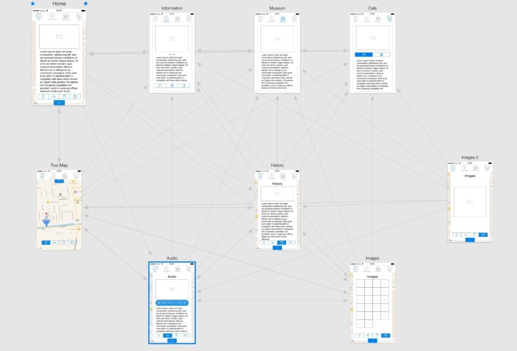
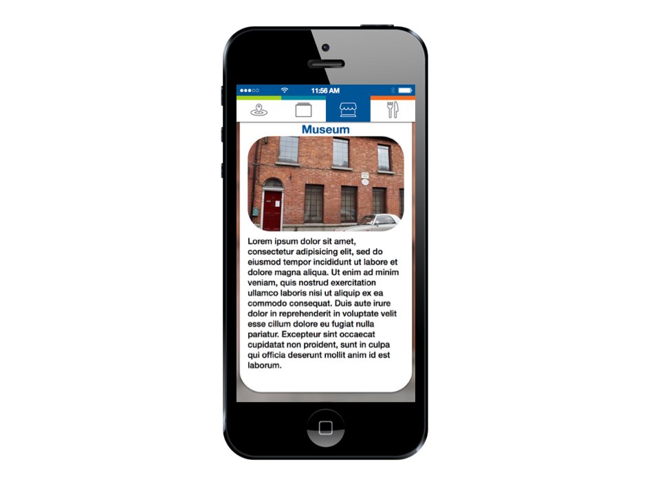
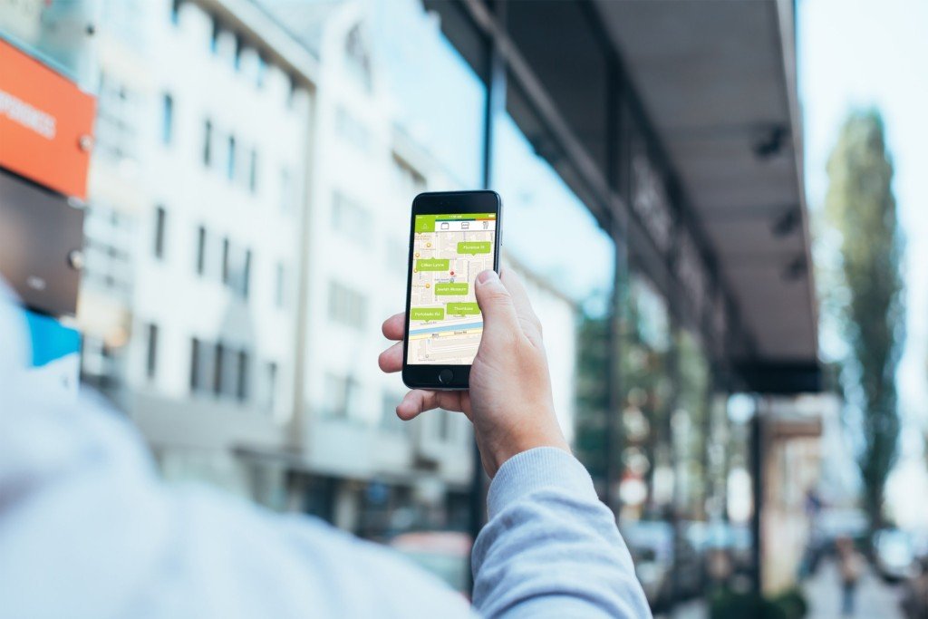
The Irish Jewish Museum app would allow the user a real-time geolocation Google maps view of the Jewish enclave with hotspots displaying the stores and business. The top navigation would give users information on the museum, it’s history and what is displayed within (note: future iterations of this app would also take advantage of QR codes displayed within the museum allowing users to scan the relevant QR code to get additional media.)
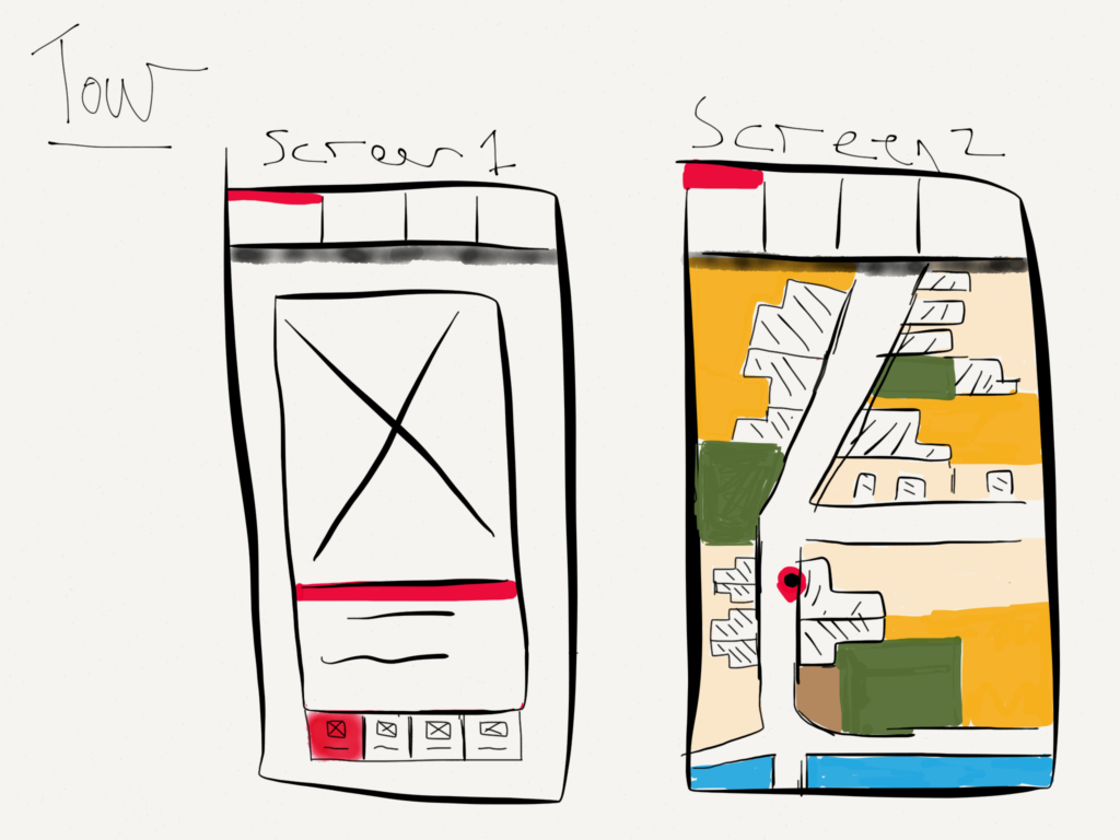

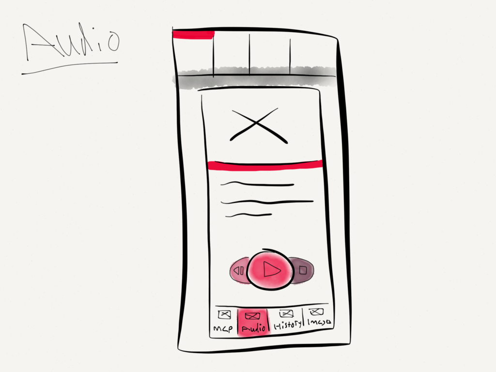

The secondary part of the app would allow users to explore the Surrounding areas historically relevance. When the user is in the geolocation Google maps view they can see highlighted areas. When the user selects the hotspot they are Given audio interviews about life in those areas along with brief history and supporting images.